Posts mit dem Label Heretic geologists werden angezeigt. Alle Posts anzeigen

Freitag, 18. Februar 2011

Climate research in the geologic past

Fig.1. Global map as published by Lyell in his "Principles of Geology" (8th edition 1850) to illustrate the past climatic changes.

The climate of a region, as experienced by daily observations of a cool morning and hot midday, was for very long time considered simply the result of the height of the sun above the horizon. This idea forced a very simple view of the distribution of climates on Earth, to the poles temperature dropped, to the equator it raised, forming so large parallel climatic belts. Such a static view of the Earth also didn’t need or even allow climate changes in the past or in the future time.
With the establishment of the deep geological time by the first geologists and naturalists it became clear that not only the distribution of sea and land changed over time, but so did climate.

Read on how Lyell explained climate change by shifting "pseudo"-continents over the globe in the post at the American Scientific Guest Blog.

Dienstag, 21. Dezember 2010

The discovery of the ruins of ice

"It has already been said, that no small part of the present work refers to the nature and phenomena of glaciers. It may be well, therefore, before proceeding to details, to explain a little the state of our present knowledge respecting these great ice-masses, which are objects of a kind to interest even those who know them only from description, whilst those who have actually witnessed their wonderfully striking and grand characteristics can hardly need an inducement to enter into some inquiry respecting their nature and origin."
James, D. Forbes (1900): "Travels Trough the Alps." [page 17]

Fig.1. C. Wolf and M. Descourtis "La Grosse Pierre Sur Le Glacier de Vorderaar Canton de Berne Province d'Oberhasli", Amsterdam 1785.

Today worldwide glaciers were studied and monitored as climate proxies, and the recent measurements show that almost all of them are retreating fast. The story about glaciers, their influence on the landscape and their possible use to reconstruct and monitor climate is an intriguing one, with many triumphs, setbacks and changes of mind.

For centuries, if not even millennia, the high altitude belt of mountain ranges were a region visited and travelled by man, however also haunted and forbidding places.
The glaciers, masses of ice enclosing peaks and extending their tongues into valleys, were considered the residence of mountain spirits, then during the medieval times the prison of damned souls (the Italian poet Dante Alighieri 1265-1321 imagined the centre of hell as a frozen wasteland) and the playground of demons, who from time to time send avalanches and debris flows into the valley.
Despite these myths there was some early insights of what glaciers actually really are made, the Greek historian and geographer Strabo (63 - 23) describes a voyages trough the Alps during the reign of Augustus and mentions

"…there is no protection against the large quantities o
f snow falling, and that form the most superficial layers of a glacier…[]. It's a common knowledge that a glacier is composed by many different layers lying horizontally, as the snow when falling and accumulating becomes hard and crystallises...[]."

However the knowledge got lost, and was only rediscovered during the Renaissance. Leonardo da Vinci´s (1452-1519) is considered one of the greatest Renaissance-geniuses,
he studied anatomy, biology and geology, however regarding the glaciers of the Alps his ideas were somehow confused, the thought glaciers were formed by not melted hail accumulating through the summer. But soon the study of nature experiences an incredible raise, and glaciers find place in various descriptions of travelling scholars.

Between 1538 and 1548 glaciers were labelled (even if not depicted) with the term "Gletscher" on topographic maps of Switzerland. In his account on the Swiss land t
he Theologian Josias Simler in 1574 describes the Rhone-glacier.
The first historic depiction of a glacier is considered the watercolour-paint of
the Vernagtferner in the Ötztaler Alps from 1601. The Vernagtferner was a glacier that repeatedly dammed up the Rofen-lake (named after the Rofen-valley), which outbursts caused heavy damage and loss of property, particularly in the years 1600, 1678, 1680, 1773, 1845, 1847 and 1848.
In 1642 the Swiss editor Matthaeus Merian the Older in his "Topographie Helvetiae, Rhaetiae et Valesiae" published various copper engravings of glaciers, and in 1706 Johann Heinrich Hottinger is interested to explain the motion of "the mountains of ice" in his "Descriptio Montium Glacialium Helveticorum."
Johann Jakob Scheuchzer, visiting in the year 1705 the Rhône Glacier, published his observations of t
he "true nature of the springs of the river Rhône" in the opus "Itinera per Helvetiae alpinas regiones facta annis 1702-1711", and confirms the idea that glaciers are formed by the accumulation of snow and they move and flow.

Fig.2. The description of the Rhone glacier according to Scheuchzer´s "Itinera per Helvetiae alpinas regiones facta annis 1702-1711", the engraving shows the "false springs at the mountain Furca" (M, N, O - left and right of the picture) and the "true springs" (J, K, L) coming from the snout of the "great glacier" (A-F), surrounded by the "small glacier" (G, H).

The increasing interest to study glaciers in the Alps is also encouraged by enthusiastic travel reports; in his "Voyage pittoresque aux glaciers" the A.C. Bordier of 1773 describes the Bosson glacier as a "huge marble ruins of a devastated city".
The naturalist Horace Benedict de Saussure (1740-1799) is fascinated by the mountains of his homeland, he climbed mountains around Geneva since 1758, and after 1760 he travelled more than 14 times trough the Alps (considering the possibilities in this time an extraordinary achievement). Between 1767 to 1779 the first volume of his "Voyages dans les Alpes" is published, were he reassumes his observations and theories about the visited glaciers, he recognized moraines and large boulders as the debris accumulated by the glacier tongue and proposes to map them to interfere the former extent of glaciers. Despite this exact statement, de Saussure failed to connect large boulders found in the foreland of the mountains to the glaciers of the Alps. He assumed that these rocks were transported on their recent locations by an immense flood. That seemed to explain why most of the boulders found scattered around the plains of Germany came in first place from the regions of Scandinavia, where the same lithology where found in the crystalline continental basement, like Precambrian metamorphic rocks and paleozoic sediments. The theory worked lesser to explain the foreland Alpine rocks - to transport boulders from the Alps the flood at least had to reach 1000 of meters.
The idea of a flood as the explanation for "glacial" deposits became largely accepted, it seemed to fit the description of the biblical flood; even Lyell and Darwin assumed that huge erratic boulders were transported by swimming ice drafts on top of a flood wave.

That glaciers could propagate far out of their valleys was however not an unusual idea for local inhabitants, who observed and experienced the growth and recess of glaciers. In academic circle this approach was a little more difficult.
A contest thought to demonstrate the former extension of Swiss glaciers initiated by the Swiss pastor Jakob Samuel Wyttenbach in 1781 (maybe inspired be the advance of the Alpine glacier in 1770) didn't arise any interest.

"Could it be proven to ourselves on the available documentation that both by the progress of our ice mountains as by our misbehaviour once for pasture most suitable land is currently covered by ice…[]"

There were only careful speculations considering a former expansion of glacier: the geologists James Hutton (1726-1797) and his friend John Playfair (1748-1819) speculated about glaciations of the northern hemisphere. In 1826 a publication by the Danish mineralogist and mountain climber Jens Esmark (1763-1839) was translated into English, in this paper Jesmark discussed the possibilities that glaciers where much greater in the past then today. J.D. Forbes and Robert Jameson (who were the geology professors of Charles Darwin at Edinburgh University, Darwin in his autobiography of 1876 remembers "The sole effect they produced on me was the determination never as long as I lived to read a book on Geology or in any way to study the science.") discussed glacial theories during their lectures. And even Buckland, who still in 1831 argued "northern region of the earth seems to have undergone successive changes from heat to cold", in 1837 was converted to Lyell's uniformatism and considered that sudden changes, like an ice age and glacier expansion, simply don't happen in geology.

In 1815 Jean Pierre Perraudin, a chamois hunter in the Val de Bagnes, told to the engineer Ignatz Venetz his theory that the glaciers once covered the entire valley, and Venetz mapped features that made him even recognize that once the entire Swiss was covered by ice. Vernetz´s lecture on the assembly of the Swiss association for natural history in 1829 found little interest, only Jean de Charpentier, director of the salt mine in the city of Bex (Western Swiss), who 14 years earlier had meet and discussed with Perraudin, this time accepted and got interested in this theory.
He begun a detailed mapping project, and in 1834 Charpentier present
ed again before the Swiss association the results of his investigations, but the flood theory had still much supporter. One of the critics in the public was a former student of Charpentier, named Jean Louis Rodolphe Agassiz, respected palaeontologist by the establishment. Charpentier invited Agassiz to visit the city of Bex and surrounding mountains, and to observe glaciers.
In the following year (1837) Agassiz held an enthusiastic lecture about glaciers, ice ages and ice shields, and in 1840 published a detailed study of modern glaciers, their deposits and their spurs in his "Etudes sur les glaciers."
Agassiz experienced the same scepticism as many other ice-age proponents before.


"I think that you should concentrate your moral and also your pecuniary strength upon this beautiful work on fossil fishes .... In accepting considerable sums from England, you have, so to speak, contracted obligations to be met only by completing a work which will be at once a monument to your own glory and a landmark in the history of science ...[ ]...No more ice, not much of echinoderms, plenty of fish..."
Alexander von Humboldt in a letter to Agassiz on 2. December 1837

However Agassiz had good connections to the most important geologist of his time. Soon he could persuade William Buckland
and later Charles Lyell. After that the most respected geologist gets convinced, the rest, as always, is history:

"advice - never try & persuade ye world of a new theory - persuade 2 or 3 of ye tip top men - & ye rest will go with ye stream, as Dr B. did with Sir H. Davy and Dr. Wollaston in case of Kirkdale Cave"
Edward Jackson, about an advice given by his professor Buckland in 1832

Fig.3. Reconstruction of the glacier that filled the valley of St. Amarin (southern Vosges, France), probably the first tentative reconstruction of an ice age glacier - from COLLOMB (1847): "Preuves de l´existence d´anciens glaciers dans les vallées des Vosges."

Agassiz research on the Unteraar-glacier established the foundations of glaciology; he recorded the dimension of the glacier, his velocity and even ventured inside the glacier by passing trough a glacial mill. Soon after 1850 the measurements methods introduced by Agassiz were carried out on various glaciers of the Alps and repeated nearly every year.

Fig.4. The Hintereis-glacier (in the centre of the picture), Hochjoch-glacier (left) and the Kesselwand- glacier, drawing by Schmetzer 1891, the Hintereis-glacier is one of the glacier with the longest active monitoring program, values about his length change reach back to 1848, since then the glacier lost 3km of his tongue.
"Aus den tiroler Alpen: Der Abschluß des Oetzthales mit dem Hochjochgletscher (links), dem Hintereisferner (in der Mitte) und dem Kesselwandferner (rechts oben). Nach der Natur gezeichnet von K. Schmetzer (1891)."

These records showed various fluctuations, but from 1850 onward a general trend of recession of glaciers in the Alps is observable. This trend has experienced a strong increase in the last 50 years, causing concern for the fast change in the landscape, the destabilisation of the rock walls once supported by the melting glaciers and the alteration of the discharge and hydrology of mountain ranges.


Fig.5. Temperature rise in the Alps and length loss of the glaciers of the Ötztaler Alps (western Austria) in the period 1900-2010. The valley glaciers with their tongues extending in the valleys showed the strongest retreat and degradation of the studied Austrian glaciers.

Samstag, 26. Juni 2010

Geology and Cyclicity: Milankovitch´s idea

"I do not think that's my duty to teach to the ignorant the most basic things, and I have never forced anyone to accept my theory, on so far nobody could expose something."
Milutin Milankovitch in 1950

Milutin Milankovitch (1879 - 1958) was born in a relatively wealthy Serbian family, so it was almost a kind of obligation for him to archive a higher education degree and later take over the family business. So he studied agriculture, but following a passion for natural sciences he went to Vienna, where he in 1904 concluded his studies as an engineer.
Five years later he returned to Belgrad where he found employment as professor for mathematical studies at the University.
Like Croll he was in search of a scientific problem worth his efforts, and in 1911, sharing some presumably good wine with a friend, he decided to develop a mathematical theory to explain climate changes on the planets of the solar system.

He studied the work of Croll, recognized his previous achievements but also noted his insufficient data. Milankovitch also consulted the work of the German mathematician Ludwig Pilgrim, who in 1904 published exact calculations of the orbital eccentricity, earth's obliquity and the rotation of the axis of earth (change of the perihelion). Pilgrim also tried to correlate the eccentricity with the occurrence of ice ages.
Between 1912 and the beginning of World War I Milankovitch published some preliminary abstracts of his developing theory, concluding that all three factors, in contrast to previous authors, are important to explain earth's climate. At the beginning of the War, Milankovitch was arrested as Serbian officer and imprisoned in his hometown Daly, but fortunately he was carrying with him his work, and so even in the first night as prisoner he continued to work. "When after midnight I looked around in the room, I needed some time to realize where I was. The small room seemed to me like an accommodation for one night during my voyage in the Universe."
Soon after he was released and travelled back to Belgrad, where he continued his work during the entire War and published some ideas about the climate of Mars and Venus.


Finally he published his theory in 1920 "Mathematische Theorie der durch Sonneneinstrahlung ausgelösten Wärmephänomene" (Mathematical theory of thermal phenomena caused by solar radiation).

Fig.1. Variations in the Earth's orbital parameters:
1. Eccentricity: the shape of the orbit around the sun.

2. Changes in obliquity: changes in the angle that Earth's axis makes with the plane of Earth's orbit.

3. Precession: the change in the direction of the Earth's axis of rotation, i.e., the axis of rotation behaves like the spin axis of a top that is winding down; hence it traces a circle on the celestial sphere over a period of time.

Together, the periods of these orbital motions have become known as Milankovitch cycles. These parameters influence the amount of solar energy on earth´s surface, especially during summer of the northern hemisphere (55°-65°N).


In his theory he postulated:
- Glaciations are caused by variations of astronomical parameters

- The parameters influence the amount of solar energy on earth´s surface, especially during summer of the northern hemisphere (55°-65°N)

- It is possible to calculate these changes, and so calculate the climate in the past.


The German meteorologists Wladimir Köppen and Alfred Wegener supported the new theory, and noted the apparent coincidence of the calculated curve with the by Penck and Brückner postulated four European glaciations.


Fig. 2. Figure from KÖPPEN & WEGENER 1924, where they correlated the calculated cycles to the know ice ages at that time.

Fig.3. Outcrop of the Trubi-Formation at Capo Spartivento (South-Italy), a succession of Globigerina-marls from the Pliocene-Pleistocene transition. The regular stripes are caused by organic rich layers, thought to be caused by changes in the biological productivity in response of changes of the astronomical parameters - the Milankovitch cycles.

References:

CHORLTON, W. (ed) (1985): Ice Ages (Planet Earth). Time-Life Books: 176
KÖPPEN, W. & WEGENER, A. (1924): Die Klimate der geologischen Vorzeit. Borntraeger, Berlin: 256


Resources:

NASA Earth Observatory: Milutin Milankovitch (1879 - 1958). Accessed 26.06.2010

Sonntag, 6. Juni 2010

Geology and Cyclicity

1842, 5 years after Agassiz's "Discourse of Neuchatel", the French mathematician Joseph Alphonse Adhémar elaborated a hypothesis to explain a cyclic occurring of ice ages. He calculated the variations of the "direction" and declination of earth axis and the "movements" of earth around the sun during the geological past.
These cyclic factors influence the time and the energy density of solar radiation that reach earth from sun, causing cyclic climatic change.
Adhémar proposed that in a period of 11.000 years the hemisphere that experiences a longer winter, resulting from these three astronomical factors, would develop in an ice age.
But in 1852 Alexander von Humboldt noted that Adhémar didn't consider an important factor in his calculations, even if one hemisphere experience lower radiation, the opposite hemisphere experience an increase, so in the end the total sum remains more or less identical.


Nevertheless the idea of the French mathematician was intriguing, and would influence later researchers.

In 1833, James Croll (1821-1890), son of a poor stonecutter of Perthshire, purchased a copy of the "Penny Magazine", a magazine for children education. He was fascinated and began extensively to read, and some time later acquired he's first books dealing with natural science; "At first I was totally confused, but then the beauty and simplicity of the ideas provided me with delight and surprise, and I began seriously to study the matter."

Croll had no easy living in the next 20 years; he travelled the country, most time working as casual labourer, and in 1850 managed (for a brief time) the only Scottish pub were no alcohol was allowed.
He then found work as a maintenance supervisor of the Andersonian College in Glasgow, where he had access to the library and the hosted scientific works, a knowledge resource that he grateful exploited.

"At that time, the question of what could have triggered the ice age was much discussed among geologists. So in the spring of 1864, I directed my attention to this topic."

From 1864, Croll corresponded with Sir Charles Lyell, on links between ice ages and variations in the Earth's orbit. This led to a position in the Edinburgh office of the Geological Survey of Scotland, as keeper of maps and correspondence, where the director, Sir Archibald Geikie, encouraged his research. He also corresponded with Charles Darwin on erosion by rivers.


Croll, based on observations of the astronom Urbain Jean Josef Leverrier, used in his calculations an important factor that Adhémar did not know, the "movements" of the perihelion and aphelion on earth's ecliptic (precession of the equinoxes). He published his research in the book "Climate and Time, in Their Geological Relations" in 1875.


Fig.1. Glacial and interglacial conditions when eccentricity is at its superior limit, from CROLL1875, frontispiece (from FLEMING 2006).

Fig.2. Variations in the earth's orbit for three million years before 1800 A.D. and one million years after it, from CROLL 1875, following p. 312 (from FLEMING 2006).

Geikie wrote about the work of Croll: "The astronomical theory seems to me the best solution to the present ice age riddle. It bears in it all the decisive factors for the occurrence of alternating cold and warm periods, and accounts for the peculiar character of glacial and interglacial climates."


But there was a problem, even if dating methods at these times were only approximate, geological evidences supported a very young age of glacial deposits, but after Croll´s theory the last glacial period had ended 80.000 years ago. When Croll died, highly respected, geologists considered his theory wrong.
Geikie resumed: "It may well be, that with certain modifications of his views; one day we will solve the secret. But for now we must be continue to work and wait."

The modifications as hoped by Geikie will come only years later, and a glass wine will be the first step to solve the problem of the cyclicity of glacial periods:
Geology and Cyclicity: Milankovitch´s idea.


Fig.3. Orbitally forced cyclic sedimentation in the Trubi Formation of Zanclean age at Scala dei Turchi, in the Rossello composite section (Sicily), that represents the template for the Pliocene Series.

Fig.4. Orbitally forced cyclic sedimentation as expressed in the uppermost part of the Trubi Formation and in the overlying Monte Narbone Formation at Punta Piccola (Sicily), where the Piacenzian GSSP has been defined.


References:

CHORLTON, W. (ed) (1985): Ice Ages (Planet Earth). Time-Life Books: 176

CROLL, J. (1875): Climate and Time, in their Geological Relations. A theory of secular changes of the Earth's Climate. D. Appleton and Company, New York: 630

FLEMING, J.R. (2006): James Croll in Context: The Encounter between Climate Dynamics and Geology in the Second Half of the Nineteenth Century. History of Meterology 3: 43 - 54

Dienstag, 9. März 2010

"On the Distribution of Erratic Boulders..." by C. Darwin

The papers submitted by C. Darwin to the Geological Society are available online Darwin´s Papers:

C. Darwin
'On the Transportal of Erratic Boulders from a lower to a higher level'
Quarterly Journal of the Geological Society 4: 315-323.
http://jgslegacy.lyellcollection.org/cgi/reprint/4/1-2/315

C. Darwin
'XXVII.—On the Distribution of the Erratic Boulders and on the Contemporaneous Unstratified Deposits of South America'
Transactions of the Geological Society of London s2-6: 415-431.
http://trn.lyellcollection.org/cgi/reprint/s2-6/2/415

Samstag, 7. November 2009

Continental drift

Nov, 1880 - Nov, 1930

"The presence of those seeking the truth is infinitely to be preferred to those who think they´ve found it."
T. PRATCHETT (2003): Monstrous Regiment.

Illustration from Thomas Burnet´s book "The Sacred Theory of the Earth", published in 1684, where he tries to explain the shape of the earth by the biblical flood. Parts of the crust of earth broke up (first drawing), releasing water from the underground. This water covers the entire planet (second drawing), and finally flowing back in the fissures, leaves back a shattered crust that now forms islands and continents (last drawing).

Already after the first maps of the American continent were published (1507 and after) and become public, the similarity between the coast of Africa and America intrigued geographers and naturalists, and this fascination continued in the following centuries.
In 1620 the E
nglish philosopher Francis Bacon noted the jigsaw form in his "Novum Organum" and claimed that "it's more then a curiosity", and 38 years later the munch Francois Placet published "The break up of large and small world's, as being demonstrated that America was connected before the flood with the other parts of the world." He argued that the two continents were once connected by the lost continent of "Atlantis", and the sin flood beaked them apart.

The great naturalist Alexander von Humboldt explored South America from 1799 until 1804, and observed that the similarities between the two coastlines were not only restricted to the morphological pattern, but also geological features: mountain chains that seemed to end on the one continent, continued on the other , the Brazilian highland remembers the landscape of Congo, the Amazonian basin has it's counterpart in the lowlands of Guinea, and the mountain ranges of North America are - geologically - very similar to the old European mountains.
But still the flood argument was a strong one, and so he argued that the Ocean represents a large, ancient river bed, flooded by the biblical catastrophe. The French zoologist Jean-
Baptiste Lamarck (1744-1829) developed a theory by itself, explaining the discovery of fossil marine animals on the dry land, he proposed that the continents "move" slowly, but irresistible, around the globe. The east coastlines of the single continents were eroded by the sea, but in the same rate new sediments were deposited on the west coast, so doing, the land were "flooded" many times by the oceans. Unfortunately, also for the lack of evidence for his theory, Lamarck was not capable to find a publisher for his "Hydrogéologie", and printed in 1802 on his own behalf 1025 copies, but only a small number of books could be sold.
The new century saw the birth a new therory to explain the shape of Earth, formulated by the American geologist James Dwigth Dana (1813-1895) - mountains and continets were products of the cooling, and shrinking earth.

After the theory of Dana, the modern continents represent remnants of the former earth crust, or the first parts of earth that solidified after the formation of the planet. The Austrian Geologist Eduard Sueß published in "Das Antlitz der Erde (1883-1909)" this hand coloured map, showing the primordial continents "cores", today separated by younger, during the contraction of Earth formed, and today water filled basins.

But this therory, explaining some aspects, couldn´t explain the irregular distribution of mountain ranges on erath, and why eras with strong tectonic movements alternate with "quie
t" eras.

George Darwin, the son of Charles R. Darwin, explained the formations of the continents as result of the detachment of the moon from earth 57 million years ago. The American geologist Frank Taylor in contrary tried to prove that the moon was captured by earth some 100 million years ago, and the resulting tide waves rip apart the single continent on the planet.

Antonio Snider, an American scientist living in Paris, was the first in 1858 to publish a schematic representation of America and Africa forming a single continent. But he also explained the break up of the two landmasses by the strength of the great flood. Still no mechanism was known to explain if, and how, continents could move over the planet´s crust.

This 1858 drawing represents one of the first schematic maps to explain the drift of continents. In contrary to other naturalist, and later geologists, Antonio Snider-Pellegrini assumed a sudden, and very fast movement, caused presumably by the biblical flood.

Samstag, 15. August 2009

Introducing the cave bear

On October 22 of the year 1794 a young German medicine student submitted his “dissertatio” to the philosophical faculty of the University Leipzig. In this work, the 23 year old Johann Christian Rosenmüller described a well preserved skull of a bear discovered in a cave near the village of Burggaillenreuth in the Franconian Alb (Central Germany). Caves and fossil bones are widespread in this region, already in 1774 the german priest Johann Friedrich Esper (1732 – 1781) , recognising that the bones do not belong to a brown bear, claims – missing other material to compare - that they represent remains of a polar bear. In the following years other authors agree that the fossils can not attributed to known bear species, but only Rosenmüller describe this “unknown creature” as a new species – and because of the rich discoveries in caves – he names it “cave bear” Ursus spelaeus ROSENMÜLLER 1794.

The illustration of the holotype - skull for the species Ursus spelaeus in the work of ROSENMÜLLER 1795 from the “Zoolithenhöhle” near Burggaillenreuth (Franconian Alb). The specimen today is lost.

In 1795 Rosenmüller, after supplementary studies, publish a second description and confirmation for the new established species. He also rejects the contemporary speculati
ons about the genesis of the bone accumulations as result of a flood catastrophe, and propose simply a slow, but consistent accumulation and deposition trough animals dying by natural causes inside the caves:

„Wir können das Dasein einer solchen Menge fossiler Knochen nicht leichter erklären, als wenn wir annehmen … daß die Tiere, von denen sie sind, in denen Höhlen geleb
t, sich daselbst fortgepflanzt haben und drinnen größtenteils gestorben sind” (We can easily explain the existence of such a quantity of fossil bones, as if we assume that the animals, from which they come, have lived in those caves, have reproduced in them and have finally also died inside them).
ROSENMÜLLER 1795


250 years later the Cave bear is one of the best studied mammals of the ice age, and among others one of the best known by a broader audience. This results surely by the large number of bones found of this animal, and also the location of the remains in caves, where it maybe influenced the legends of “cave occuping dragons”.

Arnold Böcklin (1827 - 1901).

References:

ROSENMÜLLER, J.C. (1794): Quaedam de ossibus fossilibus animalis cuiusdam, historiam eius et cognitionem accuratiorem illustrantia, dissertation, quam 22. Octob. 1794 ad disputandum proposuit Ioannes Christ. Rosenmüller Heßberg-Francus, LL.AA.M. in Theatro anatomico Lipsiensi Prosector assumto socio Io. Chr. Aug. Heinroth Lips. Med. Stud. Cum tabula aenea. O.V. Leipzig
ROSENMÜLLER, J.C. (1795): Beiträge zur Geschichte und näheren Kenntniß fossiler Knochen. Georg Emil Beer. Leipzig


Sonntag, 28. Juni 2009

World heritage !

The Dolomites on Friday 26.06.2009 were accepted to enter the list of the UNESCO World’s heritage, not only for their natural, but also cultural importance.
The Dolomites played and play a central role for the history of geology and paleontology.

The stratigraphic succession of the Schlern mountain in a book of general geology of 1907.

The area of the Dolomites in the Southern Alps has attracted geologists since the early 19th Century, the vast outcrops and the sudden change of different lithologies – and so sedimentation conditions – was an ideal field for studying sedimentological and also tectonic questions. One of the most important achievements’ was the recognition that the outstanding carbonatic peaks and mountain groups are remains of ancient carbonate platforms and coral reefs. In early days of geology less was known about sedimentation in oceans, only selective probing was possible by dragging samples of the bottom of the sea, and so only in 1842 Darwin formulated a first hypothesis on atoll formation. Influenced by this model, intensive field mapping was carried out, and in 1860 the German geologist Ferdinand von Richthofen (1833-1905) recognised as first the organic origin of the carbonate rocks of the Schlern, in the valley of Fleims and Fassa. In the work of Johann August Edmund von Mojsisovics (1839-1907) “Die Dolomitriffe von Südtirol und Venetien” (1879), where he described the stratigraphic succession of the reef built-up and basin succession, the research on old reefs gave back important impulses to the interpretation of modern reefs.

In Leopold von Buch´s work "Esquisse d´une carte geologique de la parte meridionale du Tyrol" (1822) the author distinguishes carbonatic from dolomitic rocks.

In the map of Edmund Mojsisovics (1878) he distinguishes different formations by various different colors.

The outcrops in the Dolomites also helped to clarify an ongoing quarrel between geologist, proponents of the Plutonism, and geologist, proponents of Neptunism. The questions were if all know rocks have either a pure volcanic origin, or were deposited in an aquatic milieu.
The Italian mining engineer Conte Giuseppe Marzari-Pencati observed in 1806 in the valley of Fassa that granite covered carbonates, so the first has to be originated later. An impossibility for the scientific hypothesis of Neptunism of that time.

Sketch of the outcrop with granitic rocks protruding in calcareous rocks by Marzari-Pencati (1849).

Montag, 13. April 2009

The lost continent ... or Wallacea

In 1858 the small island of Gilolo (today known as Halmahera) in the Moluccas archipelago was one of the remotest regions left on the globe.
A letter send on the 9. March 1858 from the nearest post station – on the island of Ternate- had first to be shipped to Singapore. From there a post ship of the British P & O Steamship Company, connecting Hong Kong to Suez, brought it on the African continent. By being transported until Alexandria, the letter where again shipped over the Mediterranean sea to Paris and Rotterdam, and finally London. So after three months finally the letter arrived timely in the morning to Down House, Bromley, Kent – 26 kilometres southeast of London, and 12.000 kilometres east of New Guinea.

This letter contained a 20 page long article with the title “On the Tendency of Varieties to Depart Indefinitely from the Original Type” - containing first concepts to maybe explain the rich biodiversity, the geographical distribution and the development of new species from ol
der ones in Indonesia – to enlarge upon a similar thema of the 35 years old author published in a paper in 1855.
The author of the letter to C. Darwin was Alfred Russel Wallace, an autodidact in natural science born in a poor family on 8. January 1823 in the welsh city of Usk.


A photograph of A.R. Wallace taken in Singapore in 1862 (from Wikipedia)

Working first as a surveyor and then as a teacher, he developed a passion for botany and natural science, finally so strong, that in 1848 he started on an expedition to South America. Only in 1852, after four years of collecting an incredible variety of animal and plant species, he decided to return back to England.
But then the catastrophe – the ship on which he was travelling, the trader “Helen”, cached fire and sunk in the North Atlantic Ocean. Wallace could save only some dra
wings – when he finally arrived to England, 1. October 1852, he virtually had lost everything – his collection, his payment (he made a living by selling collected specimens to museums and collectors) and his hope to get reputation by the prestigious british scientific establishment. Only the insurance sum for his transported collection saved him from financial ruin. But lacking all his collected specimens and data he was able to publish only an “abstract” of his discoveries, denominated “A narrative of Travels on the Amazon and Rio Negro”, a book, poorly considered at this time.
Swearing to never again travel by ship, just one year later the old passion grow so strong, that he embarked on a ship to Indonesia, one of the poorest known regions by the European scientist and naturalists.

The 20. April 1854 he arrived to Singapore. He will remain for 8 years, travelling for more than 22.000 kilometres, collecting and sending back to England more then 125.660 specimens of animals, and discovering 1.500 new species of insects and birds.
This second expedition will be published in 1969 in the book “The Malay Archipelago”, and will establish Wallace as founder of the scientific discipline of biogeography.


The voyage of Wallace between 1854 an 1862 (References).

Ironically it was he’s bad luck that give him the opportunity of an important discovery. 31. January 1856 he missed the ship that should bring him to Sulawesi. For 4 months he was “trapped” in Singapore, until he decided to take a detour by passing on the islands of Bali and Lombok.
On these two islands he noted something important; eve
n if the two islands are separated only by a 30 kilometres broad sea passage, the species of animals found differ considerably, dominated by one side by tigers, rhinoceros, primates and on the other side by kangaroos, koalas and birds of paradise. He will describe these two regions in his paper “On the Zoological Geography of the Malay Archipelago” (1859), separating the west ndio-malayan from the east austro-malayan region.“This islands differ far more from each then another in their birds and quadrupeds then do England and Japan, broths of which features animals common on the Eurasian landmass.”
Even if Wallace couldn’t know about the regional tectonics of Indonesia, nor the changes in sea level, he argued that “Such facts can be only explained by great changes of the earth surface."
The explanation first supposed by Wallace will find confirmation only later.
During the ice age vast amounts of water where trapped in the polar ice caps, the sea level during the maximal expansion of the ice was 180m lower then today, creating a landmass where today is sea, called in the east "Sunda-land" (after the continental shelf) connecting Borneo, Sumatra, Java and Bali with Asia, and in the west "Sahul-land", connecting New Guinea with Australia. The islands of Celebes, Timor and Flores, remaining isolated even with sea level low, are referred as "Wallacea". Only islands or regions surrounded by deeper sea represent barriers that animals coming from the Asian or Australian continents couldn’t reach. This barrier will be become known as Wallace Line.

Bathymetry of Indonesia, showing areas in red within a depth of 200m under sea level.

Mittwoch, 1. Oktober 2008

William Smith

Writing some notes on the history of geology and glaciology, I “noted” how fascinating this theme is – so in future I will try to spend some time and place on the blog to present extraordinary personalities in geology or related sciences. Hope you enjoy the idea, and find some new or primary unknown facts behind the names that we can so often read in textbooks.

I will begin with a man that I admire much, a pioneer in an even today young science:
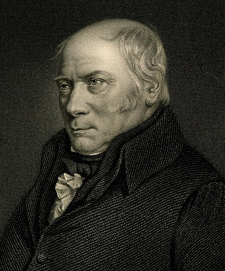

Fossils have been long studied as great curiosities, collected with great pains, treasured with great care and at a great expense, and shown and admired with as much pleasure as a child's hobby-horse is shown and admired by himself and his playfellows, because it is pretty; and this has been done by thousands who have never paid the least regard to that wonderful order and regularity with which nature has disposed of these singular productions, and assigned to each class its peculiar stratum.


William Smith, notes written January 5, 1796

In the morning of the 31 of August 1819 the doors of the King´s Bench prison in London release some debtors, and a man - stubby, approximately fifty years old – hurry up to leave the place.
Ten weeks earlier the bailiff had taken him directly from home – Buckingham Street no. 15, one of the better places in London – after he missed to pay a debt of 300 pounds to Mr. Charles Cornally.
But the doors of his house are barred, valuables, papers and maps – all his work- pawned. The very same day he will leave London.
For over 20 years he travelled thousand of kilometres trough the entire Kingdom, noted outcrops, mapped them, trying to ensure a vision. A vision of an unseen, an unknown world, and he would be the first to draw a map, a unique map, a never before seen map, of this mysterious world. A world so near, directly under our feet’s, but still poorly understand and ignored.

His passion for outcrops, stones and fossils had a huge cost; he has been laughed at his ideas by the noble academic gentlemen’s, and he is misunderstood by his contemporary.
The call him “Strata Smith” because his interest to explore mines and other artificial outcrops, like canals or stone quarries.

William Smith was born on March 23 1769 in the village of Churchill, in the county of Oxfordshire, into a respectable farming family. His father died when he was seven, so his mother brought him to the farm of his uncle.
And just here the young William makes an encounter that will change everything. In these parts of Oxfordshire, for the “long pound”, a weight measure used to weigh butter –ca. 600g- are used non the common iron weights, but rounded stones, flat on the one side, with a diameter of 10 centimeters. They are commonly found in the nearby quarries. Smith is fascinated of this stones, why they resemble the sea urchins, that he has seen in the books or on the coast of the sea, distant more then 160 kilometers from the place where they are now found. If these are remnants of animals, why are they petrified, and why some of them resemble animals, that no scientist has ever seen? Commonly this fossils are attributed to the great flood, in a time, where still the age of the earth is debated, ranging form 4004 years to a maximal amount of incredible 1 million years.

Puzzled by this mystery, he starts to seek and collect minerals and fossils. He is an enthusiastic autodidact; he studies the landscape, learns geometry, surveying, and mapping, and is interested in hydraulics and hydrology.

At the age of eighteen he became an assistant surveyor, learning his trade from the master surveyor Edward Webb. Surveying required Smith to travel all over England; in 1794 and following years he toured the entire country. In an England of land reforms and industrialisations, detailed maps were essential to plan and construct streets and canals, and good surveyor were requested.
Here Smith can his apply his knowledge, the job of surveying canal routes requires detailed knowledge of the rocks through which the canal was to be dug. Most of his work time he walks, up to 80 kilometres per day are nothing extraordinary, and he continues to note his observations in his diary.
In 1792 he works for the rich coalmine owner Elisabeth Jones in Somerset. In this time he lives in a property of the lady – Rugbourne Farm, that he will later call – the birthplace of geology, because of his habitude here to sit in a niche and study his rocks.
While studying the technical problems of the mine (high water groundtable) he notes that the coal-bearing layers are over- and underline by a characteristic succession of sandstones and marls. Always is the coal formation overlain by marine, and then non-marine depositions. Always is the coal stratum underline by a grey clay – the ancient soil on which the coal forming giant ferns and horsetails grown, millions of years ago.
Smith, like so oft before, examines the local rocks very carefully. While doing this, Smith observed that the fossils found in a section of sedimentary rock were always in a certain order from the bottom to the top of the section. This order of appearance could also be seen in other rock sections, even those on the other side of England, maybe on the entire world there is a order, and whoever can read and understand it, can much easily find the coal – the black gold of the 18th century.


. . . each stratum contained organized fossils peculiar to itself, and might, in cases otherwise doubtful, be recognised and discriminated from others like it, but in a different part of the series, by examination of them.


This is a statement of the "principle of faunal succession." The layers of sedimentary rocks in any given location contain fossils of a definite age in a definite sequence; the same sequence can be found in rocks elsewhere, and hence the strata with the same age and biocenosis can be correlated between locations. The principle of deposition, a stratum that lays deeply in a succession is older, and vice versa, was not new. But Smith was the first to proof this hypothesis by using fossils, as guide fossils. Geological maps before Smith mapped and catalogued rocks by their inorganic characteristics, sandstones, marls and chalks. Still further differentiation was only possible maybe by colour or other minor properties. This classification was very restricted, it showed no apparent pattern, only to many colours, or to less colours.


Smith has discovered a ulterior classification scheme, a scheme that can differ rocks with no doubt, even if they look very similar.


Ammonites, characteristic fossils for the Mesozoic, and the most appreciated fossils by Smith.

In the summer of 1795 he supervises the excavating of a more than 40 kilometres long canal between Camerton and Limpley Stoke. The salary is excellent, Smith can verify his hypothesis, and finally he is accepted by literate gentlemen’s, which admire his knowledge on fossil determination.
In 1796, after been fired because of a technical debate, Smith was elected to the agricultural society at Bath, and began to discuss his ideas with others who were interested in rocks and fossils. His friends forced him to public his idea, but only hesitating he began to write notes and draw up local geologic maps.

In 1816 he publishes his observations, describing for ever strata of the United Kingdom the characteristic fossils:

Strata - Identified by organized Fossils.

Unfortunately, Smith's map was overlooked at first by the scientific community of the time; his humble origins and limited education were an obstacle to success in learned, God-given society. His financial problems grow, and in 1816 (sigh!) he was forced to sell his greatest achievement, his 2657 exemplars counting fossil collection. Finally he was arrested and his property confiscated. The papers and his maps were acquired by a friend, which at least returned him his work.

The man and his fossils can be imprisoned, but not his idea.

A diagram of 1888, showing the sequence of strata and their characteristic fossils. Notice that at this date, the recently proposed Ordovician (1878) System had not yet been accepted, nor the Paleocene (1874) or Oligocene (1854) as epochs of the Cenozoic. Instead of “Precambrian” or “Primary” this scale uses the term “Laurentian”, since the studies of Precambrian rocks had made the most progress in the Laurentian region of the Canadian Shield.


The modern application of fossils in stratigraphy – without which geology doesn’t exist- is virtually unlimited. Without correlation between outcrops, sections and wells there is no possibility to reconstruct the extension of layers, which possibly contain resources like coal, oil and many minerals or rocks.
Furthermore, until the rocks are dated, there is no possibility to reconstruct the depositional and structural development of the area. Through much of the Phanerozoic, and in general ways at least the upper part of the Proterozoic, fossils offer the most precise means of correlation available. Today there are supplementary methods for (absolute) dating and correlating rocks, but still fossils are the most precise and cheap method in the field.


A Blues in honor of Smith...

It´s all there locked in the stone

the truth is told in fossilized bone.


References:


SMITH, W. (1816-1819). Strata identified by organized fossils, containing prints on coloured paper of the most characteristic specimens in each stratum. London: W. Arding.

WINCHESTER, W. (2001). The Map that Changed the World: William Smith and the Birth of Modern Geology. New York: Harper Collins.