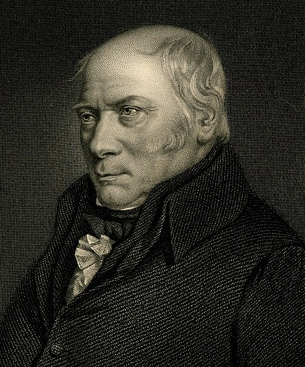
I will begin with a man that I admire much, a pioneer in an even today young science:
In the morning of the 31 of August 1819 the doors of the King´s Bench prison in London release some debtors, and a man - stubby, approximately fifty years old – hurry up to leave the place.
Ten weeks earlier the bailiff had taken him directly from home – Buckingham Street no. 15, one of the better places in London – after he missed to pay a debt of 300 pounds to Mr. Charles Cornally.
But the doors of his house are barred, valuables, papers and maps – all his work- pawned. The very same day he will leave London.
His passion for outcrops, stones and fossils had a huge cost; he has been laughed at his ideas by the noble academic gentlemen’s, and he is misunderstood by his contemporary.
The call him “Strata Smith” because his interest to explore mines and other artificial outcrops, like canals or stone quarries.
William Smith was born on March 23 1769 in the village of Churchill, in the county of Oxfordshire, into a respectable farming family. His father died when he was seven, so his mother brought him to the farm of his uncle.
And just here the young William makes an encounter that will change everything. In these parts of Oxfordshire, for the “long pound”, a weight measure used to weigh butter –ca. 600g- are used non the common iron weights, but rounded stones, flat on the one side, with a diameter of 10 centimeters. They are commonly found in the nearby quarries. Smith is fascinated of this stones, why they resemble the sea urchins, that he has seen in the books or on the coast of the sea, distant more then 160 kilometers from the place where they are now found. If these are remnants of animals, why are they petrified, and why some of them resemble animals, that no scientist has ever seen? Commonly this fossils are attributed to the great flood, in a time, where still the age of the earth is debated, ranging form 4004 years to a maximal amount of incredible 1 million years.
Puzzled by this mystery, he starts to seek and collect minerals and fossils. He is an enthusiastic autodidact; he studies the landscape, learns geometry, surveying, and mapping, and is interested in hydraulics and hydrology.
At the age of eighteen he became an assistant surveyor, learning his trade from the master surveyor Edward Webb. Surveying required Smith to travel all over England; in 1794 and following years he toured the entire country. In an England of land reforms and industrialisations, detailed maps were essential to plan and construct streets and canals, and good surveyor were requested.
Here Smith can his apply his knowledge, the job of surveying canal routes requires detailed knowledge of the rocks through which the canal was to be dug. Most of his work time he walks, up to 80 kilometres per day are nothing extraordinary, and he continues to note his observations in his diary.
In 1792 he works for the rich coalmine owner Elisabeth Jones in Somerset. In this time he lives in a property of the lady – Rugbourne Farm, that he will later call – the birthplace of geology, because of his habitude here to sit in a niche and study his rocks.
While studying the technical problems of the mine (high water groundtable) he notes that the coal-bearing layers are over- and underline by a characteristic succession of sandstones and marls. Always is the coal formation overlain by marine, and then non-marine depositions. Always is the coal stratum underline by a grey clay – the ancient soil on which the coal forming giant ferns and horsetails grown, millions of years ago.
Smith, like so oft before, examines the local rocks very carefully. While doing this, Smith observed that the fossils found in a section of sedimentary rock were always in a certain order from the bottom to the top of the section. This order of appearance could also be seen in other rock sections, even those on the other side of England, maybe on the entire world there is a order, and whoever can read and understand it, can much easily find the coal – the black gold of the 18th century.
. . . each stratum contained organized fossils peculiar to itself, and might, in cases otherwise doubtful, be recognised and discriminated from others like it, but in a different part of the series, by examination of them.

This is a statement of the "principle of faunal succession." The layers of sedimentary rocks in any given location contain fossils of a definite age in a definite sequence; the same sequence can be found in rocks elsewhere, and hence the strata with the same age and biocenosis can be correlated between locations. The principle of deposition, a stratum that lays deeply in a succession is older, and vice versa, was not new. But Smith was the first to proof this hypothesis by using fossils, as guide fossils. Geological maps before Smith mapped and catalogued rocks by their inorganic characteristics, sandstones, marls and chalks. Still further differentiation was only possible maybe by colour or other minor properties. This classification was very restricted, it showed no apparent pattern, only to many colours, or to less colours.
Smith has discovered a ulterior classification scheme, a scheme that can differ rocks with no doubt, even if they look very similar.
 Ammonites, characteristic fossils for the Mesozoic, and the most appreciated fossils by Smith.
In the summer of 1795 he supervises the excavating of a more than 40 kilometres long canal between Camerton and Limpley Stoke. The salary is excellent, Smith can verify his hypothesis, and finally he is accepted by literate gentlemen’s, which admire his knowledge on fossil determination.
In 1796, after been fired because of a technical debate, Smith was elected to the agricultural society at Bath, and began to discuss his ideas with others who were interested in rocks and fossils. His friends forced him to public his idea, but only hesitating he began to write notes and draw up local geologic maps.
Unfortunately, Smith's map was overlooked at first by the scientific community of the time; his humble origins and limited education were an obstacle to success in learned, God-given society. His financial problems grow, and in 1816 (sigh!) he was forced to sell his greatest achievement, his 2657 exemplars counting fossil collection. Finally he was arrested and his property confiscated. The papers and his maps were acquired by a friend, which at least returned him his work.
The man and his fossils can be imprisoned, but not his idea.

A diagram of 1888, showing the sequence of strata and their characteristic fossils. Notice that at this date, the recently proposed Ordovician (1878) System had not yet been accepted, nor the Paleocene (1874) or Oligocene (1854) as epochs of the Cenozoic. Instead of “Precambrian” or “Primary” this scale uses the term “Laurentian”, since the studies of Precambrian rocks had made the most progress in the Laurentian region of the Canadian Shield.
The modern application of fossils in stratigraphy – without which geology doesn’t exist- is virtually unlimited. Without correlation between outcrops, sections and wells there is no possibility to reconstruct the extension of layers, which possibly contain resources like coal, oil and many minerals or rocks.
Furthermore, until the rocks are dated, there is no possibility to reconstruct the depositional and structural development of the area. Through much of the Phanerozoic, and in general ways at least the upper part of the Proterozoic, fossils offer the most precise means of correlation available. Today there are supplementary methods for (absolute) dating and correlating rocks, but still fossils are the most precise and cheap method in the field.

It´s all there locked in the stone


Keine Kommentare:
Kommentar veröffentlichen