Mittwoch, 31. Dezember 2008

Spooky Geology: At the Mountains of Madness

The last day of the year is a good time to bring on various spooky geopredictions, and possible future geological achievements. But there are mysteries that never should be discovered, secrets that never to be solved, welcome to “SPOOKY GEOLOGY”.

“I am forced into speech because men of science have refused to follow my advice without knowing why. It is altogether against my will that I tell my reasons for opposing this contemplated invasion of the antarctic - with its vast fossil hunt and its wholesale boring and melting of the ancient ice caps. And I am the more reluctant because my warning may be in vain.”

At the Mountains of Madness is a horror story by the American writer H. P. Lovecraft, written in February/March 1931 and originally serialized in the February, March and April 1936 issues of Astounding Stories (one of the first pulp- and horror fiction magazines).
The story follows the tradition of the Cthulu-mythos - anyways presenting a more science (-fiction) approach to explain the rise and fall of the ancient god, and especially the elder ones. The story is written in first-person perspective by the geologist William Dyer, a professor from Miskatonic University (one of the institutions that possess a copy of the forbidden Necronomicon). A geological Antarctica-expedition discovers first strange fossils, eons of years older then all other signs of life on our planet, and finally a mountain range, much higher and darker then the Himalaya in the remotest corner of this frozen world. But after a carefully investigation at the borders of the mountain range of more strange fossils, contact get lost with the team, and the narrator makes his way to discover what happened at the Mountains of Madness.


Lovecraft had a lifelong interest in the exploration of the Antarctic continent. The biographer S. T. Joshi notes, that "Lovecraft had been fascinated with the Antarctic continent since he was at least 12 years old, when he had written several small treatises on early Antarctic explorers.”By the 1920s Antarctica was one of the last unexplored regions of the earth, where large stretches of territory had never seen the tread of human feet. Contemporary maps of the continent show a number of provocative blanks, and Lovecraft – as a writer- could exercise his imagination in filling them in. In fact the first expedition of Richard Evelyn Byrd took place in 1928-1930, the period just before the novella was written, and Lovecraft mentioned the explorer repeatedly in his letters, remarking at one point on "geologists of the Byrd expedition having found many fossils indicating a tropical past".
Lovecraft's was not only a passionate autodidact in geology, but also in American classic literature. Most obvious literary source for At the Mountains of Madness is Edgar Allan Poe's lone novel, The Narrative of Arthur Gordon Pym of Nantucket, whose concluding section is set in Antarctica. Lovecraft twice cites Poe's "disturbing and enigmatic" story in his text, and explicitly borrows the mysterious phrase "Tekeli-li" from Poe's work. Also, a graduate student, seeing at the arrival of the expedition on the McMurdo-Sund the active volcano Mt. Erebus, cites poetry by E.A. Poe to describe the scenery.


Many of the first Lovecraft's stories involve features that appear to be supernatural, such as monsters, demons and the occult, without clear explanation from where they come, or what they are. However, Mountains appears to explain the origins of such elements like the occult symbols or to "gods" such as Cthulhu in rational terms, by terrifying scientific facts - like the fossils, or inscriptions found on cyclopic walls of a sunken city. Mountains explains many elements of the "Cthulhu Mythos" and the origin of the crinoid-like very, very old elder ones .

Lovecraft with this story not only presents a weird tale, but also insights of the geological conceptions nearby 100 years ago - worth to be known by ever geologist to dare to approach the outer limits of geomadness.


ph´tagn 2009 by the "Unspeakable Vault of Doom"

Samstag, 27. Dezember 2008

Vegetation on Alpine rockglacier surfaces

Rockglaciers are widespread in the alpine environment, where they can be regarded as reliable indicators of permafrost. Active rockglaciers are tongue-like debris masses, which show a slowly creeping and on the first view vegetation lacking surface. But anyway still some plants can be found here.
In combination with geophysical methods the vegetation cover can give indications for the recent activity of rockglaciers, or help to reconstruct the temporal development where geomorphological indicators are absent.
For plants they represent an ulterior challenge for colonization and growth. Surface morphology and surface instability, both resulting of the movement of the rockglacier, have been found to exert important effects on vegetation patterns developing on it. Traditional studies addressing relationships between vegetation and surface instability in the alpine environment have been carried out on scree slopes and moraines. In both habitats, plant cover and patterns of surface movement are controlled primarily by slope angle and gravity. Relationships between vegetation patterns and surface instability in arctic and alpine regions have been the object of studies focusing on community typology, growing strategies and adaptations to mechanical disturbance, root mechanical properties, and vegetation dynamics.

Along with the type of rock that composes the rockglacier, the average diameter of debris and the movement velocities influence the type of plant succession and cover that can establish.
Missing fine material, and so missing colonisation niches for plant seedlings, seems to favourite plants that can grow between boulders, like Geum-species or shrubs. Active rockglaciers shows a colonisation by lichens, except for the front where pioneer species like Cerastium, Oxyria and the clubb moss Huperzia can be found.

Cerastium uniflorum (Caryophyllaceae)

Oxyria digyna (Polygonaceae)

Huperzia selago (Lycopodiaceae)

The species poor lichen assemblage develops in the middle of rockglacier,in direction of the rooting zone the lichen cover diminishes, to lack completely in the rooting zone. Lichens can be also used for dating the rockglacier by lichenometry.
A high movement causes a coarse-textured substrate; finer material fell off or between the greater, moving boulders. The resulting mechanical stress prevents the establishment of epilithic lichens on boulders.


Rhizocarpon geographicum


Brodoa intestiniformis

The vegetation patterns on active rockglaciers differed from adjacent stable areas and from inactive rockglaciers, probably because of the stressful conditions associated with substrate movement. Highly unstable sites on active rockglaciers were easily recognized by the absence of mosses and lichens. The distributional pattern of vascular plants is not strictly related to the surface instability, but depend on a combination of environmental factors, mainly substrate texture and movement intensity.

CANNONE, N. & GERDOL, R. (2003): Vegetation as an Indicator of Surface Instability in Rock Glaciers. Arctic, Antarctic and Alpine Research. Vol. 35(3): 384-390

BURGA, C.A.; FRAUENFELDER, R.; RUFFET, J.; HOELZLE, M. & KÄÄB, A. (2004): Vegetation on Alpine rock glacier surfaces: a contribution to abundance and dynamics on extreme plant habitats. FLORA 199: 505-515

Freitag, 26. Dezember 2008

Snowfalls triggering rockfalls

The conspicuous snowfalls since beginning of December, combined with relatively mild temperatures before and after, have triggered some rockfalls in the region of Southtyrol.
The sunny weather and the resulting mild temperatures during November have prevent the freezing of the soils, and the meltwater of the snow/ice can now easily infiltrate soil and bedrock, triggering sliding and collapsing of material (numbers refers to locations on map):


Climatic diagram for the last 60 days, line- mean 0° limit-altitude (correlating with mean air-temperature), blue bars – precipitation events (mainly snowfalls) , red bars – rockfall events.


5) 04.12.2008: Between the villages of Birchabruck and Gummer a rockfall with a volume of 150m3 occurred, blocking the street.
8) 11.12.2008: rockfalls occurring on a footpath on the "Säbener Felsen" (Klausen)
1) 16.12.2008: In the morning (3:00 a.m.), a large boulder (diameter 2m) felt on the street between the village of Latsch and Kastelbell, damaging the street, and rolling in the nearby river.
2) 16.12.2006: Shortly after midday a rockfall occurred in the village of Schlanders, damaging the backside of a house.
3)18-19.12.2008: A landslide with a volume of 5000m3 damages and covers the street between the village of Blumau and Breien.
4) 18-19.12.2008: A rockfall with a volume of 50m3 in the same area damages heavily a protection wall, only a second wall could stop the boulders and prevent damaging of the underlying street.
6) 01.12-26.12.2008: Because of high danger of rockfall and avalanches the Mendel-Pass street between Kaltern and the Province Trient is closed since the first snowfalls in the first December-week.
7) 22.12.2008: Two residents were forced to leave their home in the village Stummerberg (Zillertal-Austria), the heavy snowfalls-rainfalls caused on 8:30 p.m. creeping of a part (15m broad) of the slope behind the house.

Donnerstag, 25. Dezember 2008

The twelve days of Geology

On the first day of Christmas the Geoblogosphere gave to me, a list for christmas gifts in geology .

On the second day of Christmas the Geoblogosphere gave to me, a bunch of symbols for geomorphological mapping in high mountains, and a list for christmas gifts in geology.

On the third day of Christmas the Geoblogosphere gave to me, a fear mongering documentary, a bunch of symbols for geomorphological mapping in high mountains, and a list for christmas gifts in geology.

On the fourth day of Christmas the Geoblogosphere gave to me, extinction, a fear mongering documentary, a bunch of symbols for geomorphological mapping in high mountains, and a list for christmas gifts in geology.

On the fifth day of Christmas the Geoblogosphere gave to me, open-access journals in geology, extinction, a fear mongering documentary, a bunch of Symbols for geomorphological mapping in high mountains, and a list for christmas gifts in geology.

On the sixth day of Christmas the Geoblogosphere gave to me, the ghost of (65Ma) Christmas past, open-Access Journals in geology, extinction, a fear mongering documentary, a bunch of Symbols for geomorphological mapping in high mountains, and a list for christmas gifts in geology.

On the seventh day of Christmas the Geoblogosphere gave to me, volcanoes cooling climate,the ghost of (65Ma) Christmas past, open-Access Journals in geology, extinction, a fear mongering documentary, a bunch of Symbols for geomorphological mapping in high mountains, and a list for christmas gifts in geology.

On the eigth day of Christmas the Geoblogosphere gave to me, snow preventing geology-work, volcanoes cooling climate, the ghost of (65Ma) Christmas past, open-Access Journals in geology, extinction, a fear mongering documentary, a bunch of Symbols for geomorphological mapping in high mountains, and a list for christmas gifts in geology.

On the ninth day of Christmas the Geoblogosphere gave to me, mapping tools for Permafrost, snow preventing geology-work, volcanoes cooling climate, the ghost of (65Ma) Christmas past, open-Access Journals in geology, extinction, a fear mongering documentary, a bunch of Symbols for geomorphological mapping in high mountains, and a list for christmas gifts in geology.

On the tenth day of Christmas the Geoblogosphere gave to me, a worldwide glaciation, mapping tools for Permafrost, snow preventing geology-work, volcanoes cooling climate, the ghost of (65Ma) Christmas past, open-Access Journals in geology, extinction, a fear mongering documentary, a bunch of Symbols for geomorphological mapping in high mountains, and a list for christmas gifts in geology.

On the eleventh day of Christmas the Geoblogosphere gave to me, an Accretionary Wedge, a worldwide glaciation, mapping tools for Permafrost, snow preventing geology-work, volcanoes cooling climate, the ghost of (65Ma) Christmas past, open-Access Journals in geology, extinction, a fear mongering documentary, a bunch of Symbols for geomorphological mapping in high mountains, and a list for christmas gifts in geology.

On the twelfth day of Christmas the Geoblogosphere gave to me, twelve geology days of Christmas, an Accretionary Wedge, a worldwide glaciation, mapping tools for Permafrost, snow preventing geology-work, volcanoes cooling climate, the ghost of (65Ma) Christmas past, open-Access Journals in geology, extinction, a fear mongering documentary, a bunch of Symbols for geomorphological mapping in high mountains, and a list for christmas gifts in geology.

Dienstag, 23. Dezember 2008

Accretionary Wedge: The Iceman story


The December Accretionary Wedge is hosted by Kenneth Clerk in his “Office of Redundacy”. He is asking – which scientific advancements have directly affected your interests? As first point I choose a discovery that happened not far away where I worked for my thesis. It is also mentioned in it, even is it not strictly geological, but as second point, I like to think interdisciplinary (or at least try) – and so even a archaeological discovery can be useful to understand the glacial history of a research areas:


Location of the discovery point (black rectangle) of the bronze-age mummy in the Ötztaler Alps. Blue areas represents the glacier extends in 2003, the red line the glacier extends during the Little Ice Age (ca. 1850).

The finding in the late summer 1991 of a prehistoric mummified corpse at the upper edge of the accumulation area of an alpine glacier, together with its unique set of artefacts, provided new information on the cultural development of bronze-age cultures, but also insights on the glacier dimensions during the little-known phases of major glacier shrink age that characterized the warmest parts of the Holocene. This phase is practically undocumented by glacial sediments, and is only recognizable by proxy-data like changes in pollendiagrams or dating organic materials, over- or underlying glacial or proglacial sediments.

The sudden burial of the corpse in a permanent snow cover occurred 5300–5050 cal yr B.P., indicating a significant climatic change that induced glacier expansion at the beginning of Neoglaciation.


The "Similaun" as highest peak (3597m a.s.l.) with his two glaciers, the "Similaun" in foreground, and the "Niederjoch"in background. Until ca 1970 the glaciers flowed together, but the shrinkage in the last years was notable.

The marked ablation during the summer 1991 (helped by a pronounced sunny weather and the deposition of saharian dust on the glacier ice, that diminished the albedo) of the small glacier near the Similaun Hut, in the Tyrolean Alps, brought the corpse to the surface. The preservation of the corpse was possible thanks to its location in an almost horizontal gully in the bed rock, in which it remained motionless, frozen to the ground in cold ice. This corpse is the highest prehistoric find (ca. 3280m a.s.l.) in the Alps. The discovery is also notable by the presence of a rich collection of several exceptionally preserved items of clothing and equipment. The mummy was dated by the C14-method to 4.500+-30 to 4580+-30 yr B.P., that corresponds to a calibrated age of 5300-5050 yr B.P., and resulted older then a first relative dating by the accompanying tools, especially by the bronze-axe.


The snowfield on the right of this picture represents the depression in which the corpse was found.

The small glacier that revealed the mummy lies on the northern slope of the alpine divide, east of the Finail-Spitze-mountain (3514m a.s.l.). Until the 1970, the glacier was part of the much greater Niederjoch Glacier, a composite alpine glacier that descends northward in the Nieder Valley. But only in the last 5 years the Niederjoch-glacier lost 60-100m length.
During the last glacial maximum (LGM, ca. 18.000 yr), the entire area was completely ice-covered, only narrow and steep arêtes and horns protruded from the ice. In the area of the Similaun Hut sharp trimlines in a height varying from 3060m NW of the Similaun Hut to 3400m on Finail-Spitze divides the uppermost frost-shattered crests from the lower slopes, smoothed by glacial erosion. The trimline can also recognized locally as marked weathering line that separates different oxidized surfaces (the bed rock consists of Fe-rich gneiss and schist).
A second trimline is marked by an abrupt change in lichen diameter (from 100mm above to 40mm below) and density. The dating by lichenometry attributes this glacier stand to the Little Ice Age (LIA), which generally corresponds to the maximum Holocene glacier elevation.
Some soil horizons were found in depression between 3000 and 3215m a.s.l. and dated to 5615+-55 yr B.P. (6450-6300 cal yr B.P.) and 3885+-60 yr B.P. (4416-4158 cal yr B.P.). Similar recent soils needed at least 5 to 12 centuries for development, suggesting that the climatic conditions on the site were for a long time relative favourable and constant.
The Iceman and his site reveal that between 9000 and 5000 yr B.P. the mountain glaciers were smaller than in the second half of the Holocene. About 6400 cal. yr B.P. and for several centuries after, an ice-free peripheral belt allowed the accumulation of organic matter and developments of relatively thick soils. The Iceman was killed on the site during summer, and covered by snow soon after. Until 5300 to 5050 cal yr B.P. ago, a rapid climatic change took place, producing a persistent snow cover and a glacier expansion, which conserved the body until his discovery in modern times.


The valley of Tisa, on the italian side of the Alps, the Iceman came from the Valley of Schnals (in the background the modern artificial lake on the bottom of the valley) and passed the relict rockglacier in the foreground. The modern trail passes on the left side.

Detailed information about the lifestyle and environment of the Iceman is based on both on-site and off-site data. The on-site data are represented by his clothing, the wooden artefacts, plant macro remains recovered during two archaeological excavations at the discovery site in 1991 and 1992, as well as the micro and macro fossil content of the food residue from the mummies intestines. They provide information about Neolithic edible and otherwise useful plants, the making and suitability of his equipment, prehistoric diet, the season of his death, his social status, palaeo-environment and the taphonomy of the find assemblage. Off-site data are represented by palynological and macroremains analyses of peat deposits from mires in the nearer and wider vicinity of the discovery site, which reveal the vegetation and climate history as well as human impact on the vegetation during the time of the Iceman.
Both the axe shaft and the long bow were found in the vicinity of the corpse and were made of yew (Taxus baccata). The quiver was made of caprine skin and was stiffened with hazel wood (Corylus avellana). The 14 arrows were made of the wood of the wayfaring tree (Viburnum lantana). One is repaired, the front end being restored with dogwood (Cornus). The dagger handle is made from a piece of ash (Fraxinus excelsior). Its sheath was knotted from the bark of linden (Tilia).
He also had with him two containers made of birch (Betula) bark, in one were found charcoal pieces wrapped in Norway maple (Acer platanoides) leaves.

Several wood species could be identified from the charcoal remains, which are interpreted as cold embers: probably spruce (Picea/Larix-type), pine (Pinus mugo-type), green alder (Alnus viridis), some Pomoideae which were probably Juneberry (cf. Amelanchier ovalis), dwarf willow (Salix reticulata-type) and elm (Ulmus). A backpack was constructed from a thick branch of hazel (Corylus avellana) bent into a U-shape, together with two coarsely-worked laths of larch (Larix decidua).
All in all, the majority of wood species found with the Iceman thrive in the montane regions (valley bottoms to 1,800 m),although some subalpine (1,800-2,500 m) and alpine (above 2,500 m) species are also represented. Their ecological requirements point to the transition zone between thermophilous mixed-oak forest communities (Quercetalia pubescenti-petreae) and the montane spruce forest (Piceetum montanum). Norwegian maple (A. platanoides), European yew (T. baccata), ash (Fraxinus sp.), lime (Tilia sp.) and elm (Ulmus sp.) allow to infer a humid habitat with a mineral rich, free-draining soil and a mild winter climate. All that is similar to the present-day conditions in the woodlands found on the slopes and in gorges in the lower Schnalstal and Vinschgau in South Tyrol, where it is assumed he lived.

The Schnals-valley and his entrance in a narrow gorge - the steep walls are very exposed and sunny, so that very dry-tolerant plant species can be found here, like cactus species (Opuntia ficus-indica), yew and shrubs communities and steppe-like grass patches. On more humid slopes a larch or spruce forest develops.

So the botanical evidence seems to confirm a climate comparable to modern conditions, and implies a glacial extent similar, if not slightly minor to the present.
This has very important influence on the reconstruction of past, and modern climatic and glacial development, and at last the actual discussion about climatic change.

BARONI, C. & OROMBELLI, G. (1996): Short paper – the alpine “Iceman” and Holocene Climatic Change. Quaternary Research 46: 78-83

MAGNY, M. & HAAS, J.N. (2004): Rapid Communication - A major widespread climatic change around 5300 cal. yr BP at the time of the Alpine Iceman. Journal of Quaternary Science 19(5): 423-430

OEGGL, K. (2009): The significance of the Tyrolean Iceman for the archaeobotany of Central Europe. Veget. Hist. Archaeobot. 18:1-11

Freitag, 12. Dezember 2008

Earth from Space: Snow-kissed Alps


The snow-capped, crescent-shaped Alps and Italy’s Apennines mountain chain are shown in this Envisat image. The unusual early and strong snowfall in the last days (up to 50-200cm in 24 hours) have caused blackouts and heavy traffic jams in the affected regions.
This image was acquired by Envisat's Medium Resolution Imaging Spectrometer (MERIS) instrument on 8 December 2008.

Sonntag, 7. Dezember 2008

Geology of the "Pale Mountains"

Dave Schumaker at Geology News is asking "What is your favorite place to do field work?"

Maybe it’s the variety on rocks that can be found on a place – from crystalline basement, to permo-mesozoic marine and terrestrial sediments to the quaternary cover:

"Once, all mountains in the reign of the Dolomite Mountains were dark peaks, with sheer rock walls, belted by dark forest and rich pastures.


Then one day, the prince of this kingdom encountered a beautiful girl, and felt in love with her. So did the girl. After some time, they decided to marry. The first time they were very happy, and when the old king died, they become king and queen. But one day the girl went sick and weak. The prince worried, and asked her was happened. The girl explained, that she was the daughter of the moon, and were missing the vast and white plains of her native kingdom – and if she did not return, she surely will die by this desire. So the prince decided to go with her and they returned to the moon. But the light on the moon blinded the poor prince, and he had return to earth. Sad and hopeless - missing his beloved- he wandered into the forest, and encountered dwarf. He told the dwarf his problem, and the dwarf responded:” Listen carefully, young prince, I’m the king of dwarfs, and my people was banished long time ago from his land, and we are searching for a new home. If you will promise, that we can live on the peaks of your kingdom, we will solve your problem.”
The king gave his word. In the night the dwarf people climbed the peaks of the mountains, and begun to weave the moon light, and cover the dark peaks, so it seemed that they were covered by snow.


The next day, the king, seeing the white peaks, enjoyed, and his queen returned to earth. And so the Pale Mountains - the Dolomite-Mountains - between dark peaks came to being."


This old ladinian (from the old folks living in the valleys of the Dolomites) myth tries to explain the variety of landscapes and rocks found there. But even the geological (his)story is fascinating, ranging from sunburned deserts to swallow lagoons to a frozen wasteland.


The Alps on a geological basis comprises rocks originating from two continents: The European continent to the north with the subsequently separated Penninic units (aquamarine blue and pink in the One Geology cartography project map); and to the south the Adriatic or Apulian microcontinent, a fragment of Africa, with its Austroalpine (dark red) and Southalpine units (violet). Due the Alpine orogenesis, the various units today lie side by side in a very confined space. The diversity of rocks also causes their strongly differentiated reactions against weathering and erosion, as well as against glacial abrasion during the Ice Age – and so a reason for the pronounced diversity of the alpine landscape.

An approximate bipartition in the eastern Alps is caused by a mayor fault system, the Periadriatic Line, separating the Austroalpine in the North, predominated by metamorphic rocks, from the Southalpine, mainly magmatic and sedimentary rocks.
The basement of the Southalpine unit consists predominantly of a monoton succession of quartz phyllites of the Paleozoic era.
Towards the end of the Paleozoic increasing magmatic activity started, one part of the melts remained struck in 12 km depth where it solidified; the other part reached the surface and covered enormous areas with volcanic deposits. This “Permian Athesian Volcanic Group” forms a solid fundament for the Mesozoic sediments that build up the “Pale Mountains”.

Cooling joints in ignimbrite deposits of the Auer-Formation (276-274 Ma).

Samstag, 29. November 2008

Wunderkammer

Introduction in form of a story by the Seneca-Indians (Toronto, Canada):

"Once, an orphan, living by his aunt, was hunting in the forest. Deep in the forest, after have hunted some birds, he decided to take a rest. Sitting on a large stone, he suddenly heard a voice. “Do you want to hear a story?” The young man looked up, and wondered, because nobody was there. “Do you want to hear a story?” repeated the voice. Then the young man realized that the voice was coming from the stone, where he was sitting on. “What are stories?” questioned the man. “Stories happened long time ago, my stories are like stars, they never fade away.” And then the stone narrated one story after another, until the sun reached the horizon. ”Enough for today, come tomorrow, and take with you the other people of your village.” The next day, they came, and again the stone narrated stories until sunset.” This are all my stories, remember them, and tell them to your children, so they can tell them to their children and so on.”
So all stories of humankind came in being. "


During the european Renaissance (14th to the 17th century) kings and regnants, but also artistocrats, rich merchants and mens of science collected curiosities, comprending fossils, minerals, religious or historical artefacts, antiquities, stuffed animals or at least parts of them, and displayed them in “Cabinets of curiosities/wonders” (from the german term Wunderkammer).
One of the first of these cabinets of curiosities was assembled by Rudolf II, Holy Roman Emperor (ruled 1576-1612) in Prague, mostly for representative purpose. The earliest picture of a cabinet of this kind is the engraving in Ferrante Imperato's (1550- 1625)“Dell'Historia Naturale - From the natural history*”, published in Naples in 1599, presenting the apothecary´s museum.
The picture shows a room, where every part is filled with stuff of all kind, the ceiling is occupied with preserved fishes, stuffed mammals and curious shells, with – as highlight- a stuffed crocodile suspended in the centre. Examples of corals stand on the bookcases. At the left, shelves filled with mineral specimens. Above them, stuffed birds stand against panels inlaid with square polished stone samples. Below them, a range of cupboards with boxes and covered jars - containing presumably animal or plant specimen.
On the right, shelves with books - lots of books- notable in the upper part herbars, with some plants protruding from the pages. In the front, the proud owner of all this wonders is explaining to a curious visitor.

Cabinets of curiosities, Imperato,Ferrantio (Naples, Italy - 1599). (wikipedia)

Two of the most famously described 17th century cabinets were those of the Danish physician Ole Worm (latinized Olaus Wormius 1588-1654) and the German Jesuit Athanasius Kircher (1602-1680). These cabinets were filled with preserved animals, horns, tusks, skeletons, minerals, as well as man-made objects like sculptures, mechanic automats, ethnographic specimens and even mythical creatures. Worm's collection contained, for example, what he thought was a Scythian Lamb, a woolly fern thought to be a plant/sheep fabulous creature native of Asia.

"Musei Wormiani Historia", the frontispiece from the Museum Wormianum depicting Ole Worm's (Germany)cabinet of curiosities. (wikipedia)

In 1584 Giovanni Battista Olivi described from a more scientific point of view the fish-fossils from Bolca (a small town in the vicinity of Verona)– one of the most important lagerstätten for Eocene marine fossils - displayed in the cabinet of curiosities of the veronese apothecary Francesco Calceolari.


Museum Calceolarianum in Verona (Italy) 1622, incision by G. Viscardi, rappresenting the cabinet of curiosities of the veronese apothecary Francesco Calceolari.

Eoplatax papilio, one of the most remarkable fish fossils discovered in the sediments of Bolca.

In 1796-1808 the priest Giovanni Serafino Volta published a voluminous monograph work about the rich collection of fossils from Bolca by the aristocrat Giovan Battista Gazola.


The cabinet of curiosities of the veronese aristocrat Gian Battista Gazola in the late 18th century, displaying the fossils of Bolca.

The juxtaposition of such disparate objects encouraged comparisons, finding analogies and parallels and favored the cultural change from a world viewed as static to a dynamic view of endlessly transforming natural history and a historical perspective that led in the seventeenth century to the germs of a scientific view of reality. The most “Cabinets of curiosities” can seen as the first steps to modern museums.


Paranguilla tigrina, one of the first known fossil eels.

Justitia desmaresti.

The actual modern Museum of Natural History of South Tyrol, located in Bozen – Bolzano, has also its first beginnings in the rich collection of curiosities by the amateur naturalist Georg Gasser (1857-1931). Artist and painter, he dedicated his life to the collection of minerals (2000 specimens), petrefacts (5000 specimens), shells (2000 specimens), stuffed animals or their skeletons, but also ethnographic artefacts of all kind. In 1905 he moved his private collection to the new founded city-museum of Bozen, where it was displayed, after some troubles, until 1934. Unfortunately, during the year 1931 the upcoming political system closed the museum, and Gasser died literally by “broken heart” (he suffered a heart attack after the announcement). In the following years parts of the collection was sold, or got lost.
Only in 1997, after the acquirements of the rest of Gassers collection, a new museum was founded, to revive the old concept - and even if the modern collection doesn’t display a stuffed crocodile - this small museum is worth to wonder about all this "stories" that man has and will collect…


Gasser´s private collection ca. 1900.


The salt-water aquarium in the museum.


Fotos taken in a special exhibit of the Natural History Museum of Bozen (South Tyrol, Italy).

*Imperato,Ferrantio (1599) : Dell'historia naturale di Ferrante Imperato napolitano Libri XXVIII. Nella quale ordinatamente si tratta della diversa condition di miniere, e pietre. Con alcune historie di piante et animali; sin hora non date in luce.

Freitag, 21. November 2008

I think...


"The independent and problem-solving type. They are especially attuned to the demands of the moment are masters of responding to challenges that arise spontaneously. They generally prefer to think things out for themselves and often avoid inter-personal conflicts.

The Mechanics enjoy working together with other independent and highly skilled people and often like seek fun and action both in their work and personal life. They enjoy adventure and risk such as in driving race cars or working as policemen and firefighters."


Seems to my highly illogical.

The website analyzer can be found here, and the initiator here. Don´t take it to seriously...

Montag, 17. November 2008

Ice is the enemy...

Al Gore and Hollywood leading an international conspiracy against our economy, our family, our humanity progress and my cat - no, not (only) by producing bad movies, but telling us fiction (in a movie, how dare they)!!
The worldwide economy crisis has only one reason: I drive only one car, I live only in one house in one city with one family and one cat– and so I don’t pollute and consume enough on one planet, shame on me …


Ice is still evil...

Samstag, 15. November 2008

Volcano-Ice Interactions

A lahar is a general term for a type of rapidly flowing mudflow / landslide composed of an water-satured (at least 40-80 weigth% ) mixture of volcanic deposits. The term 'lahar' originated in the Javanese language of Indonesia, meaning “wave”.

Lahars can have four main causes:

-Snow and glaciers can be melted during an volcanic eruption
-(Crater-)Lakes breakout, triggered by collapse of natural dams (lava flows, ash deposits etc.)
-Heavy rainfall, caused by precipitation from eruption cloud
-General remobilizing of volcanic deposits without implications of eruptions

Considering mainly the first category –two main premises have to be considered. The volcano, if he is not located in the Arctic or Antarctic realm, must be high enough to possess a snow cover or enable glacier formation, and he must be active in historic times.
Several mountains in the world, including Mount Rainier, Mount Shasta and formerly Mount St. Helens in the Cascadian Range, Mount Ruapehu in New Zealand, Popocatepetl in central Mexico, different Volcanoes in the Andes (like Nevado del Ruiz) are considered particularly dangerous due to the risk of lahars.

The lahars from the Nevado del Ruiz (5.321m a.s.l.) eruption in Colombia in 1985 caused the Armero tragedy (13.11.), which killed an estimated 23.000 when the city of Armero was buried under 5 metres of mud and debris. Pyroclastic flows melted ice and snow at the summit, forming four thick lahars that rushed down several river valleys. Historic lahar-events date back to the 16th century.

Popocatepetl volcano (5450m a.s.l.) is probably the most active volcano in central Mexico, and threatens more than 40 million people livingin the Mexico City area. The principal danger is rappresented by laharic events, that following the main river, can reach zones distant up to 15km from the volcano. The Ventorillo Glacier, located on the northern flank of the volcano, is the main source of meltwater during eruptions. Popocatepetl got active after 50 years of quiescence in 1994, and on 31. June 1997 a lahar with an estimated volume of 1x10^7m^3 formed from the tongue of the glacier and deposited 3.3x10^5 m^3 of material in the circumstandig river valleys.

Mount Ruapehu, or just Ruapehu (consisting of three major peaks Tahurangi, 2.797m, Te Heuheu, 2.755 m and Paretetaitonga 2.751 m), is the largest active stratovolcano at the southern end of the Taupo Volcanic Zone in New Zealand. The North Island's major skifields and only glaciers are on its slopes.
In recorded history, major eruptions have been about 50 years apart, in 1895, 1945 and 1995-1996. Minor eruptions are frequent, with at least 60 since 1945. Some of the minor eruptions in the 1970s generated small ash falls and lahars that damaged ski fields.

Between major eruptions, a crater lake, damned by volcanic ash and rocks, forms, fed by melting snow. The collapse of this natural dam, blocking the outlet of Mount Ruapehu´s crater lake, caused in the past (and presumably will cause in the future) catastrophic lahars.

Fresh lahar channels scar Ruapehu's eastern slopes (27.03.2007, wikipedia)

December 24., 1953, a lahar destroyed the Tangiwai rail bridge, causing the derailment of a train, and the dead of 151 of the 285 people aboard the train- the worst train accident in New Zealand. Until then, the danger of lahars was underestimated in the public view, and only after the tragedy a monitoring program was installed on the volcano.
The eruption in 1995 closed the ski season for that year and was followed by some more eruptions in 1996. During March 18., 2007 a lahar, with estimated 1.4 million cubic metres of mud and rocks, was documented by a film crew.

Donnerstag, 13. November 2008

Wild animal meme

Walking with beasts...

we have many
eigth
six
four
two
and 0 legs:


Crab spider on orchid, waiting for prey:

(remembers me a movie...)

Ash: You still don't understand what you're dealing with, do you? Perfect organism. Its structural perfection is matched only by its hostility.

Lambert: You admire it.

Ash: I admire its purity. A survivor... unclouded by conscience, remorse, or delusions of morality.

Samstag, 8. November 2008

Ice, cows and the creation of the world


A geologist – so the preconception- normally doesn’t deal with “things that are still alive”. But the actual (geosphere-) animals in the field meme shows that geologist, like Bryan, Life-long Scholar, Dinochick and Silver Fox appreciate the company and spotting of animals during fieldwork.
And even if some claims that cows want to take over the world (Geotripper), we have to accept that cows are in fact responsible (in part) for it’s beginning and live on earth (so the ancient vikings tell):

“In the beginning there was Ginnungagap – the nothing with no bottom. In the south it was confined by Muspelheim, the land of eternal burning fire, in the north laid Nebelheim, an eternally frozen, desolate land. Located in the center of Nebelheim there was a poisoned spring, feeding eleven poisoned rivers. In the eternal darkness and coldness of Nebelheim, the water immediately froze to ice, so that the ice could reach far up to the border of Ginnungagap. Even the poisoned vapour, emanating from the dead rivers, froze to icicles. No live could exist here.

In the heat from Muspelheim, no live could exist ether, it would burn immediately. But between these two hells, warm winds transported some sparks on the frozen water, and melted some ice.
The water flowed between the two lands, and was garnered in Ginnungagap.


From the ice emerged Audhumla (the "milk rich"), the cosmic cow. Finding nothing to grazing, because still grass wasn’t´ created, she began licking the salty ice. Licking the ice there emerged Ymir, the first giant – even if some tell that Ymir was there before Audhumla, but in this case he had to suffer famine, because only with the appearance of Audhumla he could finally drink some fresh milk.


But in every case, licking and licking for three days, from the ice emerged Buri – the first god. His son Bör wedded Bestla, the daughter of a giant, and from this relationship three sons were born: Odin, Vili and Ve. They finally killed the giant Ymir, and from his corpse they created the world, mountains, the sea, humankind, and grass, so that Audhumla and her descendants could finally graze."

Mittwoch, 5. November 2008

Hyperdisease extinction


The extinction (and extinction of species in general) of the mammoths, and a large amount of different species of the Pleistocene megafauna, is one of the most puzzling paleomysteries. Climate change, human overkill and last, but not least, a meteor were blamed to have wiped out the large mammals at the end of the ice age.
New studies now propose (or sustain) an ulterior hypothesis, a hyperdisease to explain the extinction of two endemic rat species.
In 1899 the cargo vessel "S.S. Hindustan" landed on the small Christmas island (island between Australia and Indonesia), and with the ship the black rat (Rattus rattus), and his fleas, came on land. The fleas infected the endemic species of rats (the Bulldog Rat Rattus nativitatis and Maclari`s Rat -Rattus macleari) with a new parasite, Trypanosoma lewisi. In 1908 the two species were declared extinct.
Researchers of the Norfolk University (Virginia) now have provided the evidence that a high infection (at least one third) rate between the native population caused a high mortality, and in the end the extinction of the two species. It’s the first time that research connects an extinction event between mammals with a particular disease or pathogen. In general it was assumed that a infection can not cause complete extinction, because normally a growing resistivety to the pathogen develops in the population, or the diminishing number of individuals prevents further spread of the disease.
The study maybe give new support to a controversial hypothesis to explain the Pleistocene extinction event.
A disease (in this case tuberculosis, spread by the first humans) was argued by some researchers to have caused the extinction of the Mammoth.

Dienstag, 4. November 2008

Clonig mice and mammoths..

How you get from this...

to this?
By cool science...

Cloning animals by nuclear transfer provides an opportunity to preserve endangered mammalian species. However, it has been suggested that the “resurrection” of frozen extinct species (such as the woolly mammoth) is impracticable, as no live cells are available, and the genomic material that remains is inevitably degraded. Here we report production of cloned mice from bodies kept frozen at −20 °C for up to 16 years without any cryoprotection. As all of the cells were ruptured after thawing, we used a modified cloning method and examined nuclei from several organs for use in nuclear transfer attempts. Using brain nuclei as nuclear donors, we established embryonic stem cell lines from the cloned embryos. Healthy cloned mice were then produced from these nuclear transferred embryonic stem cells by serial nuclear transfer. Thus, nuclear transfer techniques could be used to “resurrect” animals or maintain valuable genomic stocks from tissues frozen for prolonged periods without any cryopreservation.
narf...

Montag, 3. November 2008

45th Munich Mineral Show

Some impressions from 45th Munich Mineral Show


Megaloceros giganteus - the irish or giant elk, facsimile and ...

original skull, river Rhine, Germany.

Mammoths, Bison, Deer, Bear and Horse, mainly Russia

Smoky Quartz, Alps. The romans know that this mineral could be found in the mountains, and believed that this was ice so deeply frozen, that no fire could ever melt it.


Many where the treasure that man searched and extracted in the mountains (like in the Hohe Tauern regions, Austrian Alps), crystals, gems and the the most elusive of all…


GOLD !!! , here a specimen of a new discovered gold vein (August 2008), from the Aosta valley (Border Swiss-Italy). A difficult, and dangerous search...


The time has run down.

Freitag, 31. Oktober 2008

Mammoth Mummies Mystery

To honour the host of this month Boneyard XXV, who is dedicated to debunk creationist claims – a look on Mammoths, C. Heston and Pseudoscience:

"No such hypothesis is sufficient to explain either the cataclysms or the glacial phenomena; and we need not hesitate to confess our ignorance of this strange, this mysterious, episode in the history of the globe...."

BRISTOW, H.G. (1872) p.435

Some representative animals of the Pleistocene fauna are well known, in fact, extraordinary well known, because we are able not only to study bones, like happening with so many other extinct animals, but to study entire corpses – trough “mummies” found in the frozen soil of the far north. Still, much about these animals is poorly understand, questions remain about their environment, and how they died and get preserved so perfectly.
Lacking of knowledge or presumed unexplainable situations often give rise to controversial hypothesis, or in the worst case to lies and pseudoscientific claims.

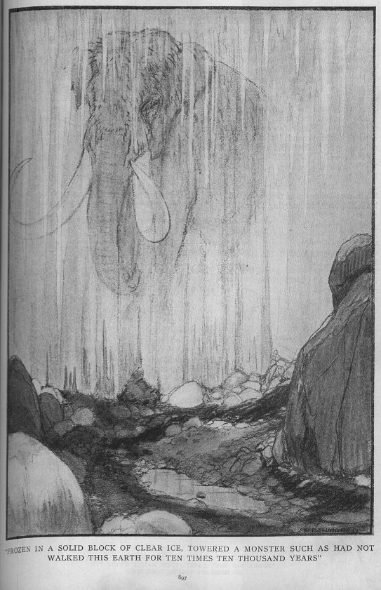
The extraordinary conservation of some carcasses of Mammoth, apparently only explainable by a rapid death and a rapid burial, brought to some speculation and wild guesses. Even more puzzling, elephants are seen as typical animals of warm climates and regions, such animal surviving in a cold, empty Tundra, seemed impossible.
During the 18 and 19th century, it seemed plausible, that Mammoths once lived in warm regions, and were killed and transported north by a great flood, where the corpses were deposited on ground, and became frozen. Even Charles Lyell, one of the founding father of geology, supported this “floater” theory.

This theory was still debated in 1848 by the arctic explorer Middendorf, even if already in 1825 the French anatomist Georges Cuvier observed the adaptations from the Mammoth to cold environments (long, dense pelage, subcutaneous fat, small ears, etc.). These controversies helped fund many expeditions, in first line organized by the Russian Academy of Sciences. They reported extraordinarily good preserved animals, but also poorly preserved, not supporting a “sudden fall in temperature”.

Fig. The most important Mammoth discoveries in Siberia.

Even in the last years pseudoscientific writers and creationists use the frozen bodies as supporting fact of their claims, and the flood hypothesis is still not dead and buried.

The American historian and writer Charles H. Hapgood (1904-1982) used Mammoths to support his Pole Shift Theory or Earth Crust Displacement Theory.
He based his idea primarily on ancient maps (the most important the so called Piri Reis Map, after admiral of the Turkish fleet), that seems to show the Antarctic continent without ice (explained by a different position of the continent, presumably more to nord), and biblical verses, that describe that the sun changed motion direction in the sky (explained by the change of the earth axis tilting).

As scientific support he cited mammoths and other Pleistocene animals, which seemed to show a rapid and catastrophic climatic change, explainable only by a catastrophic shift of the earth crust. After this theory, through the weight of the polar caps ice masses, or an enigmatic planet or asteroid, the relative position of the poles changed so suddenly, that the animals travelling on the continent, where transported from a temperate, or tropic climate so suddenly to a cold region, that they were literally shock frozen.
This, so Hapgood, happened not once, but often, and cyclic:

He reconstructed the timing and the locations of the catastrophic shifts of the polar ice capes:

90.000 B.C. Alaska
50.000 B.C. Norway
12.000 B.C: Hudson Bay
0 B.C. North Pole

Modern glaciological survey and analysis of ice cores show that the ice masses on the South Pole are at minimum 2 to 3 million years old, they on Greenland at least 120.000 years, they surely changed extensions, but they never disappeared completely. So one of the strongest arguments by Hapgood, is not supported by scientific measurements. From the geological view, he also fails to explain how it should be possible, that the entire crust of the earth can flip on the (heterogenic) mantle so easily.

Ice masses (and here I will introduce a special guest - Mr. C.Heston !) are not heavy enough to tilt the axis as supposed, and a bypassing planet large enough to influence the earth should be discovered at least, not to mention that a cyclic event had the earth thrown out of the orbit.

We also have to relativities the claim, that the bodies were frozen. The found Mammoths are never found in ice, especially not in glacier ice, a common misconception. Mummies occur in frozen silt, which contains local ice lenses or wedges, of secondary genesis. This ice maybe plays an important role in the desiccation and preservation of the carcass, as moisture, migrated from the body and frozen outside.

A different approach to support their claims is used by creationists. They see Mammoths as scientific prove of a flood, presumably Noah’s flood.
The most naive approach is to pretend the enormous number of found carcass and fossils are due a mass kill of a single (flood) event. Dating showed that ages of the carcasses reach at least from 29.000 to 4000 y B.P. (but you can still pretend that radiocarbon dating doesn´t work).
As we have seen also the affirmation, the mammoth needed a rapid burial (a common creationistic claim) is not necessary. Small carcasses, like from the mammoth calf “Dima” (discovered 1977) could cool quickly. This specimen most probably drowned in a small pound, and the cold mud cooled the carcass and prevented entirely decomposition.

Fig. Dima , a 4-6 month old Mammoth calf, considered the best preserved specimen

Animals died at the end of the summer, could become frozen during winter, and then subsequently buried during spring. It’s important to note, that sediment erosion and deposition during Ice ages differed considerably from modern sedimentation processes.

Fig. Watersatured mud "flowing" down hillside. The lack of a continues vegetation cover in the Mammoth steppe maybe caused strong redeposition of glacial sediments during snowmelt in spring.

But unfortunately, for most of the reported (historic) mammoth-discoveries, despite description, surrounding sediments or other paleontological hinds are not or only poorly mentioned – in fact the causes of death of most specimen are unknown, and the taphonomy of large carcass in Permafrost is still poorly understand.

A chapter for it’s own is the climate and the vegetation in Siberia during glacial periods. It is a misconception to compare the modern Tundra or Taiga with the Mammoth steppe, and claim that the productivity of this landscape was to poor to sustain large herbivores. The Mammoth steppe was a vegetation type that mixed cold tolerant with dry tolerant plant species, with resulting high species richness. The dry climate and the lack of precipitation prevented a long snow cover, enabling longer periods of photosynthesis. Also it is highly probable that herbivores migrated between summer and winter.

References:

GUTHRIE (1990): Frozen Fauna of the Mammoth Steppe – The story of Blue Babe.